

Day 1 / Section 1 – Minehead to Porlock Weir
Strenuous – 10 miles
“…at least if we made that first step we had somewhere to go, we had a purpose. And we really didn’t have anything better to do at half past three on a Thursday afternoon than to start a 630-mile walk.”
© Raynor Winn, The Salt Path, 2018
Getting to Minehead
Taunton Railway Station, operated by Great Western Railway (GWR), is well-connected to London and other parts of the UK. From Taunton, a bus service is available to Minehead. For walkers between Minehead and Combe Martin, the Exmoor Explorer—formerly the Exmoor Coaster—is returning for summer 2025 with a daily service running from Sunday 25 May until Sunday 31 August, with open-top buses returning from Wednesday 23 July. The Exmoor Explorer takes passengers through some of Exmoor’s most scenic and charming locations from Minehead to Ilfracombe, and is a fantastic eco-friendly transport option with £3 single fares. Plan your journey with First Bus.
Get a good night’s sleep before starting out on your epic journey at the Beach Hotel right on Minehead’s seafront just minutes from the start point (early takeaway breakfast available) or if you’re feeling a bit more leisurely, stay overnight at the medieval Exmoor village of Dunster at the Yarn Market Hotel (2 miles from start, bus available).
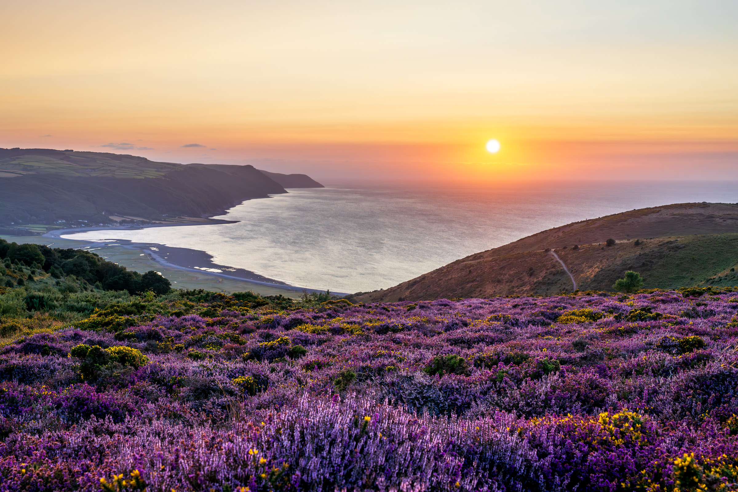
The South West Coast Path begins on the promenade in Minehead, marked by an impressive sculpture aptly nicknamed ‘The Iron Giant’, portraying hands holding a map of the Trail. In England and Wales, the National Trails are waymarked with a distinctive acorn symbol, which can be followed across the 630-miles of our National Trail. The beginning of the Path takes you through woodland, along steep cliff-tops and farm tracks, and up and down beautiful wooded combes with bracken, gorse and bubbling streams. The official route follows the improved rugged coast path via Hurlestone Combe, running closer to the coastline, or you can choose to follow the inland route, running on the moor and taking in spectacular panoramic views over the Bristol Channel from Selworthy Beacon, standing at 1,013ft (308m). This day walk ends at Porlock Bay, a large expanse of salt marsh that is a Site of Special Scientific Interest (SSSI) and a unique habitat for marine life and birds.
Stay, Eat & Do
Treat yourself to some luxury at the award winning Bossington Hall B & B (or value option at Bossington Bunkhouse) just 0.5 miles from the Path or if you’re heading into the Weir, check into the Porlock Weir Hotel or experience life on a working farm at Ash Farm B & B (2 miles from the Path). Inland at Porlock Village, pitch your tent at Sparkhayes Farm Campsite or relax in cosy cottages at the Cottage B & B or Myrtle Cottage (single nights available).
Don’t forget to get your Passport stamped at the NCI temporary station on Minehead beach before your set off or at the Flapjackery store where you can pick up some perfect walking snacks. Relax with views over the harbour at Porlock Weir at the Harbour House Coffee Shop or enjoy some local artists and homemade cakes at the Harbour Gallery & Café, or sample some delicious locally sourced seafood at The Kitchen @Porlock Bay Oysters.
Day 2 / Section 2 – Porlock Weir to Lynton
Moderate / Strenuous – 12.1 miles
“I hadn’t accounted for rarely being at sea level. The only time we’d spent near the sea had been in Minehead and the really stony shore at Porlock. We were humming. It was a relief to get on to the wooded cliffs, where hanging forests of oak stood hunched towards the cliff and the sea wind cut through the leaves.”
© Raynor Winn, The Salt Path, 2018
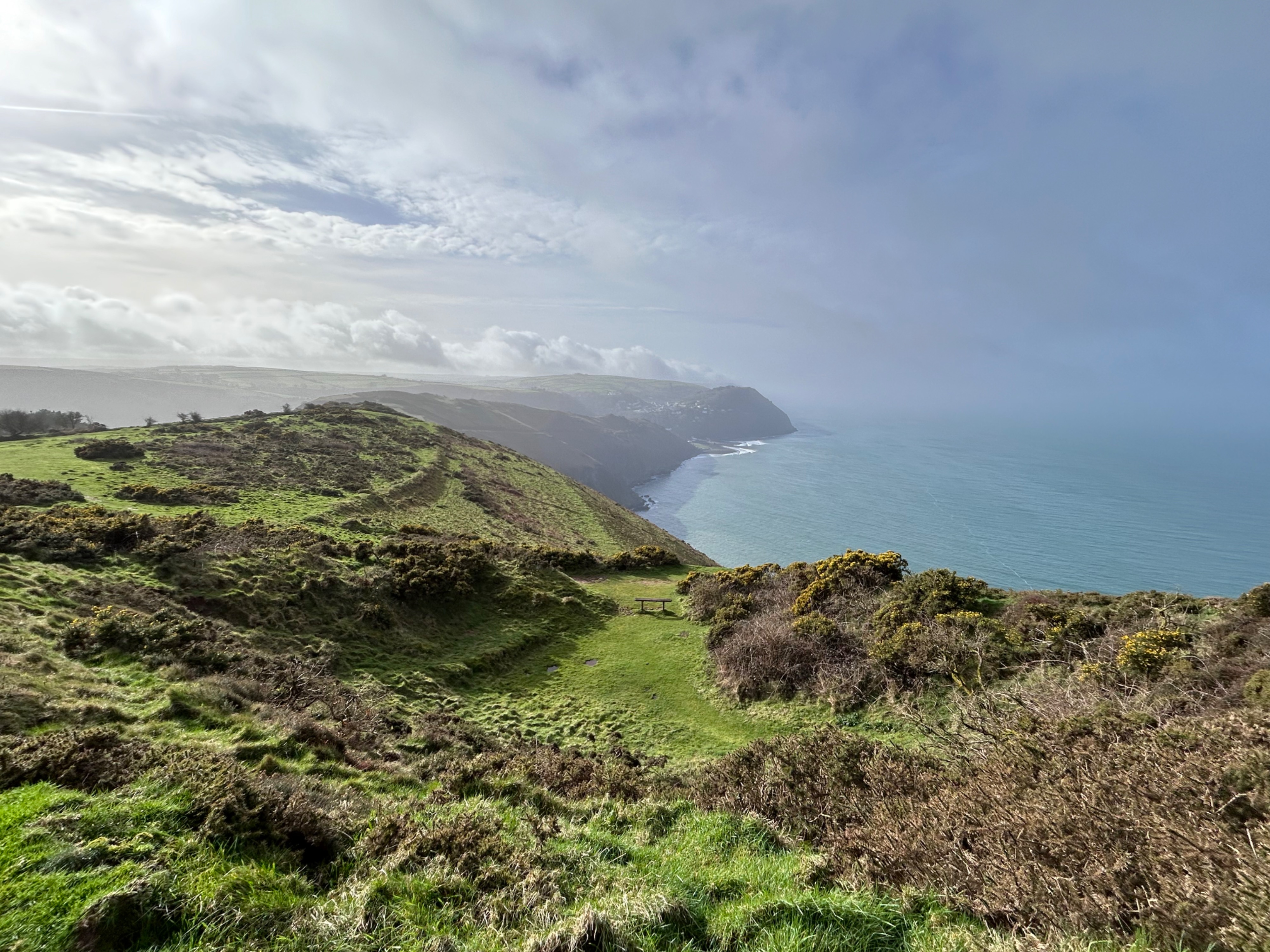
Day two sees you journeying over dramatic cliff paths, along farm tracks, through fields and beautiful wooded combes with frequent glimpses of the sea, and seasonal waterfalls and streams. Leaving the open harbour of Porlock Weir, you will soon reach Culbone, home to Culbone St Beuno Church, whose main structure dates back to the 12th century and is apparently the smallest complete parish church in England at only 35ft long. From Culbone, you can choose to follow the cliff-top route with spectacular views over Exmoor and across to the Welsh coast, or take the more direct path through the ancient oaks and rare whitebeams of Culbone Woods. Here, the woodlands were once used for burning charcoal and apparently the original burners were a colony of lepers who were forbidden from entering Porlock. If opting for the path through the woods, look out for remains of their huts! Continue towards Countisbury, before descending on zig-zag paths to Lynmouth. Lynton is vertically above Lynmouth and is reached by turning left up the steps before the funicular cliff railway, the highest and steepest water-powered railway in the world, opened in 1890.
Lynmouth marks one end of the 117-mile Devon Coast to Coast route, using the Two Moors Way and its southern extension to the south coast at Wembury. Guidebooks are available from Exmoor National Park Centre at Lynmouth.
Stay, Eat & Do
If you’re looking for an authentic back-to-basics experience, stop off at the National Trust Berry Lawn Linhay Bothy just before Lynmouth (sleeps 4, book in advance). Carry on into Lynmouth harbour for riverside comfort at East Lyn House or the quirky, family-run Bath Hotel. Head up to Lynton to discover a wide selection of B&Bs enjoying stunning views, including Sinai House and North Cliff Hotel. Alternatively, head inland and choose from a range of camping options at Caffyns working cider farm (Exmoor Coast Holidays) or Lynmouth Holiday Retreats.
Stop off along the way at the UK’s highest coastal road tea room, the Ramblers Rest Tea Room, at County Gate and pick up your passport stamp or reward yourself on arrival in Lynton with some delicious homemade treats at the stylish North Coast Cafe. For good pub grub and quirky maritime memorabilia visit the Ancient Mariner in Lynmouth.
Day 3 / Section 3 – Lynton to Combe Martin
Strenuous – 13.7 miles
“The sea broke against the base of the cliffs leading up to Castle Rock. We watched in silence. Rhythmically, repeatedly, white against black, white against black, white against black. A group of wild goats, disguised by the scrub and rock, leapt across the path close by, their long hair blown by the wind as they disappeared below…”
© Raynor Winn, The Salt Path, 2018

The third and final day in this itinerary has an easy start on tarmac to Castle Rock, turning into grassy clifftops which lead to the spectacular rock formations of the Valley of Rocks, which forms the backdrop to The Salt Path film’s poster. This is part of R. D. Blackmore’s Lorna Doone territory, and the landscape is so extraordinary that legend has explained its origin as the acts of the Devil. From here there are some challenging climbs, including reaching Great Hangman, England’s highest sea cliff at 1,043ft (318m). From here, take in the breathtaking views of Exmoor, the Welsh coast and Lundy Island. Following the path from Great Hangman, you will be led to Little Hangman and beyond to Combe Martin. During springtime, the cliff-top sections are abundant in wildflowers, including bluebells, campions, violets, celandines and primroses, and on the edge of the steep, rocky cliffs with almost sheer drops you will often see mountain goats munching on the bracken.
Stay, Eat & Do
Step straight off the Coast Path for a stay at Newbury Beach Lodge, explore friendly B&Bs like the Lion House and Channel Vista Guest House or head up the hill to the Pack of Cards pub and restaurant. There’s camping just 1 mile off the Path at Sandaway Beach Holiday Park.
Stop off along the way near the Valley of Rocks and enjoy the beautiful gardens at Lee Abbey Tea Cottage (seasonal opening).
Onward travel
Return to Minehead on the Exmoor Explorer or travel to Barnstaple on the 301 bus service from Combe Martin. From Barnstaple Town Station, it is possible to travel by bus and rail. Alternatively, taxi services include Lyn Valley taxis, Riverside Taxis (Lynton & Exmoor), Exmoor Transfers or Bossington Taxis.
Up next: Combe Martin to Croyde
A Taste of The Salt Path
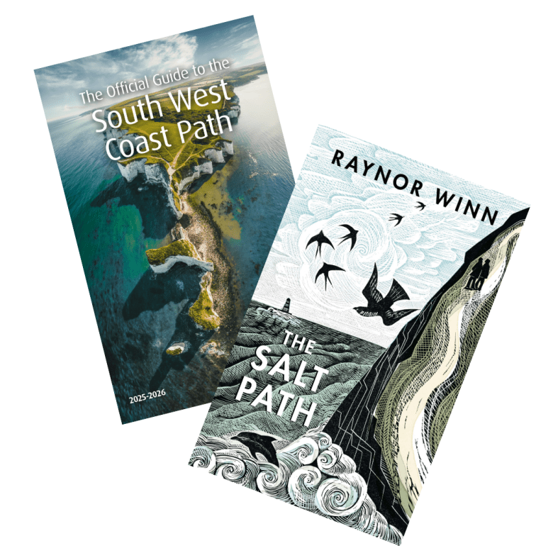
Plan your trip with the Official Guide to the South West Coast Path. The Official Guide is written and produced by the South West Coast Path Association, the charity that protects and champions Britain’s longest National Trail. Containing 52 days of walks across the entire 630-mile National Trail, tides times, accommodation providers and places to eat and drink, our handy guide is sure to help you on your journey—whether you’re planning a weekend trip or even taking on the entire trail.
Check out places to Stay, Eat & Do on the South West Coast Path, and head to our website to learn more about The Salt Path and to download our press pack.
