

Day 1 / Section 11 – Westward Ho! to Clovelly
Strenuous – 11.1 miles
“We sat around in the shelter and in the shade of the hedge watching a group of turnstones. Compact and beautiful little wading birds with white chests and mottled chestnut backs, hopping deftly between the black rock and the seaweed on spindly orange legs. Their strong pointed beaks quickly flipping stones to find the edible treats beneath.”
© Raynor Winn, The Salt Path, 2018
Getting to Westward Ho!
Whilst there is no train station at Westward Ho!, travel options are available from nearby Barnstaple by bus or taxi. Regular train services operate between London Waterloo and Barnstaple, taking 3.5 hours, and between Exeter and Barnstaple in little over an hour.
Single-night stay accommodation in Westward Ho! and nearby Appledore is limited, so check out places in Barnstaple and Bideford and hop on the No 21 Stagecoach bus to Westward Ho! to start the walk. Alternatively, book into the Waterfront Inn at Westward Ho! for comfortable B&B with sea views or there’s budget camping 2 miles along from the start of the walk at Westacott Farm.
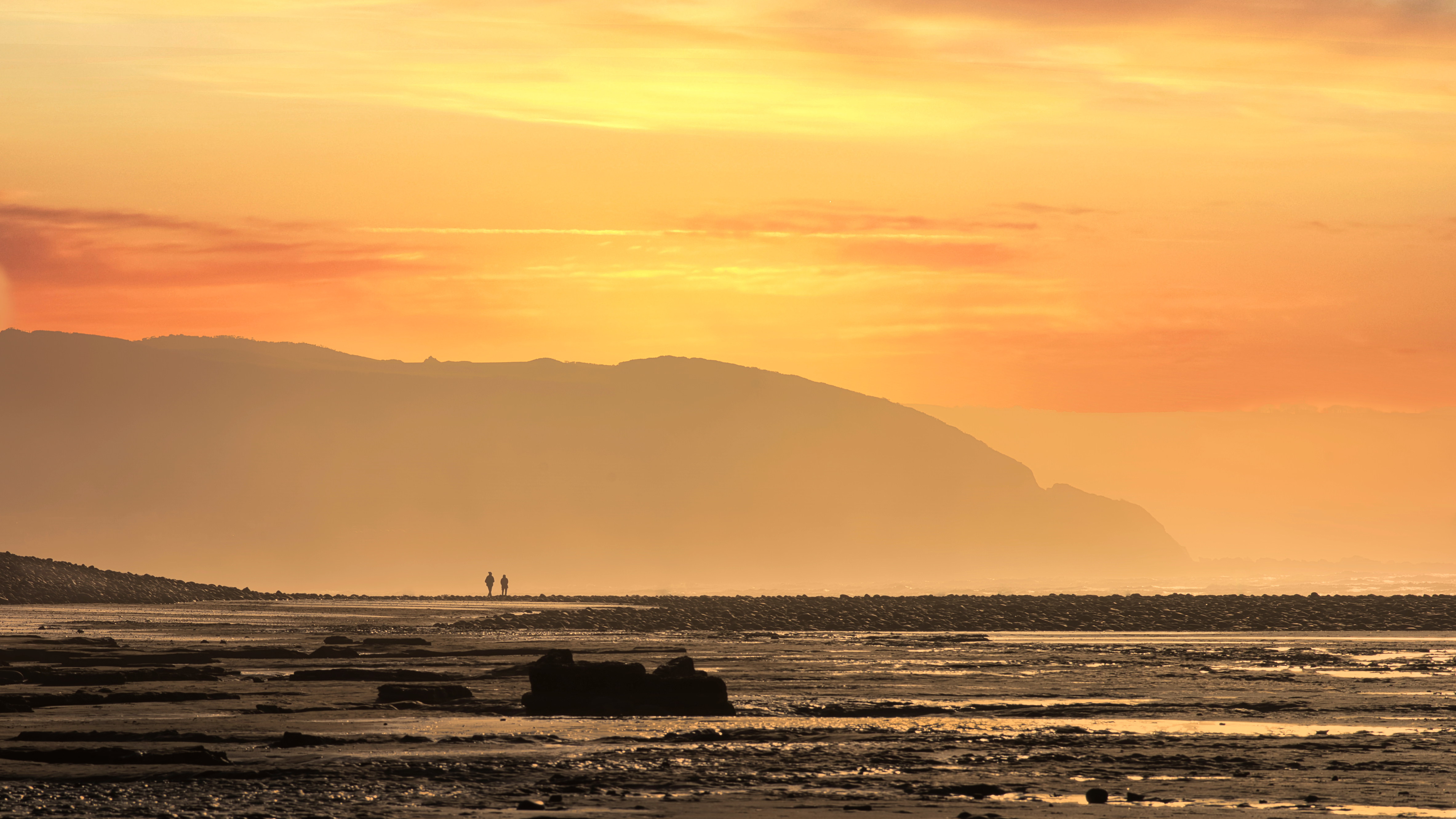
Starting in the lively surf village of Westward Ho!, famously named after Charles Kingsley’s 1855 novel of the same title, this walk begins with wide ocean views. Setting off from Westward Ho!, the route picks up a stretch of the old Bideford to Westward Ho! railway line, gradually climbing to the cliffs above. From here, the terrain gets more challenging, zigzagging and rollercoasting along exposed, open headlands. At Peppercombe, a lush, wooded valley offers a welcome change of pace as the path enters ancient woodland. The route then drops into Buck’s Mills, a picturesque hamlet nestled by the sea, before climbing once more into woodland. Here, you’ll join the Hobby Drive, a leafy track that winds high above the coast for over three miles, offering glimpses of the sea through the trees. The walk ends at the top of the cobbled main street of Clovelly, a timeless fishing village where cobbled streets and whitewashed cottages lead down to the harbour.
Stay, Eat & Do
Pack yourself a picnic for this stretch (or fuel up at the Feel Good Larder in Barnstaple, John’s Deli in Appledore, or the Pig and Olive in Westward Ho!). Look forward to stopping off for a pint and some good pub grub in Clovelly at the New Inn, or alternatively head to the harbour for stunning views and fresh seafood at the Red Lion Hotel (both have rooms available). Harbour View Cottage offers a peaceful stay in Clovelly’s cobbled high street, or make your way to Higher Clovelly for a stay at The Old Smithy B&B or Sierra Hill B & B.
Day 2 / Section 12 – Clovelly to Hartland Quay
Moderate / Strenuous – 10.3 miles
“It’s wild here, a corner where tides, winds and tectonic plates collide in a roar of elemental confusion. A place of endings, beginnings, shipwrecks and rockslides. The viewpoint by the railings caught the air and rushed it up in a jet of cold, oxygenated, sea-spray fizz. I flew with the power of the uplift; alive, we were alive.”
© Raynor Winn, The Salt Path, 2018
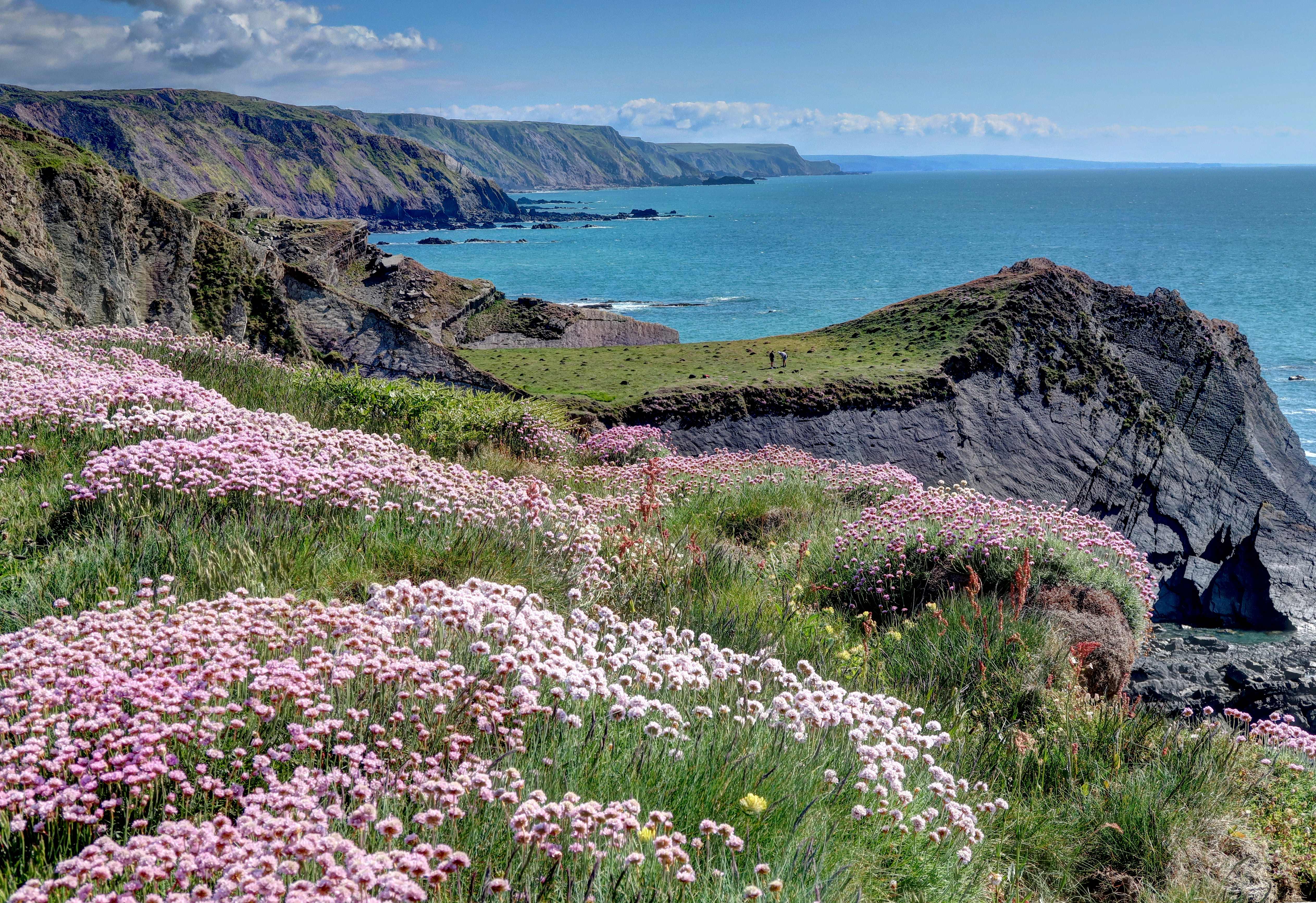
Day two is a demanding but deeply rewarding leg, leading you across the wild beauty of the Hartland Peninsula. The route begins gently, winding through ancient, earthy woodland before emerging onto open cliff-tops and pastoral fields, scattered with kissing gates. Before long, you’ll reach the “Angel’s Wings”, an unusual stone seat built in the 19th century by Sir James Hamlyn-Williams, once the squire of Clovelly. This elegant shelter, carved with angelic figures, was designed as a lookout across Bideford Bay toward his daughter’s home at Youlston. From here, the path plunges into a deep valley to Mouth Mill, where the remains of 18th-century lime kilns still stand, a glimpse into the area’s industrial past. A climb through Mouth Mill woods brings you onto Bursdon Moor, where expansive fields open up and the promontory of Hartland Point appears on the horizon. After rounding Shipload Bay, the route curves around Hartland Point, marking a dramatic shift in landscape. The woodland gives way to rugged, barren cliffs, where the Atlantic crashes below and the trail travels up and down steep river valleys. Just before the final descent to Hartland Quay, pause at the old Folly Tower, perfectly framing the distant spire of St Nectan’s Church in Hartland village.
Stay, Eat & Do
Make sure you’ve got your sandwiches for this stretch – first stop for refreshments is the stunningly positioned Hartland Point Refreshment Kiosk, where you can pick up your Coast Path Passport stamp too. Carry on to the Hartland Quay Hotel where you can stay the night and enjoy some well-deserved food and drink at the Wrecker’s Retreat. There’s camping (and pixie huts) with full facilities just half a mile off the Path at Stoke Barton Campsite, cosy B&B at Gawlish Farm or Quincecote Shepherd’s Hut. Hartland village is a further 5km from the Quay where there’s more options including The Anchor Inn and Hartland Caravan Park (call 07789756789). Elmscott Youth Hostel is a further hour’s walk from the Quay.
Day 3 / Section 13 – Hartland Quay to Bude
Severe – 15.2 miles
“Dropping into a shady combe and over a wooden footbridge, a sign unexpectedly welcomed us to Kernow, the local name for Cornwall. The north coast of Devon had passed under our feet, leaving a new county stretching away to the west, disappearing into the horizon.”
© Raynor Winn, The Salt Path, 2018
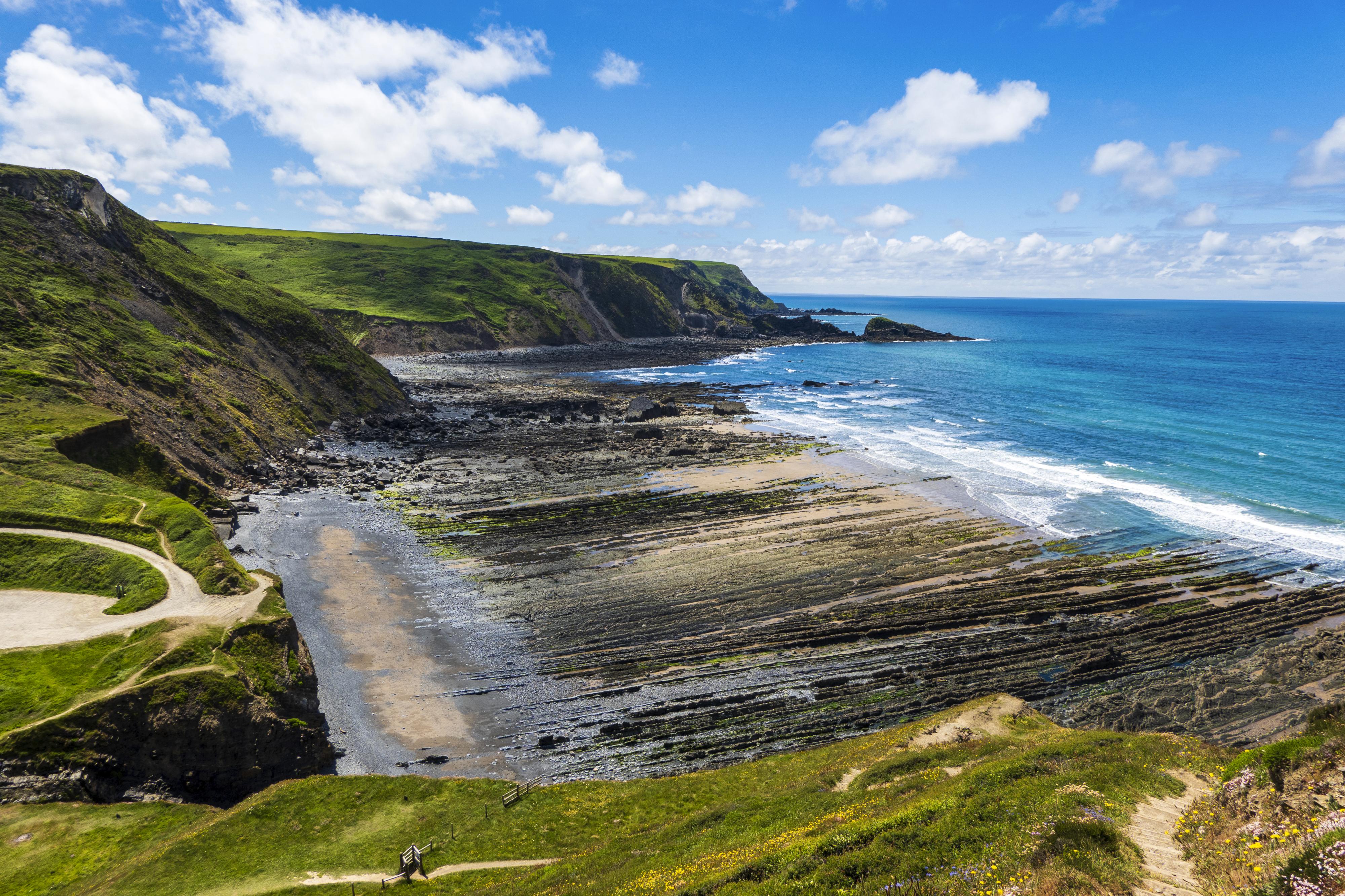
Often described as the toughest section of the South West Coast Path, this dramatic day involves a series of ten steep, deep river valleys, a relentless rollercoaster that demands stamina but rewards in spades, with tumbling waterfalls, secluded combes, and far-reaching sea views. From Hartland Quay, the trail climbs behind St Catherine’s Tor before following the cliff edge to Speke’s Mill Mouth, where a spectacular 157-foot waterfall crashes down in three tiers before running into the sea. A little further on, cross a wooden footbridge and choose your route: either keep to the cliff-top over Swansford Hill or detour inland up the valley before rejoining the path. Look out for a small hut, once used by playwright and poet Ronald Duncan, furnished with benches, a desk, chair, and a visitor’s book. Continue over Vicarage Cliff, where you’ll pass Hawker’s Hut, a tiny driftwood shelter once frequented by eccentric vicar-poet Reverend Robert Hawker. It’s now the smallest property in the National Trust’s care. Beyond here, the path crosses into Cornwall at Marsland Mouth, the official county border, before dropping into Welcombe Mouth, a dramatic, rocky beach with rich geology and rock pools revealed at low tide. Continue up and down the river valleys, passing landmarks like Elmscott Church, the radio dishes, and Duckpool Bay, a wild beach reached via a wooden footbridge. From Sandy Mouth, the path gradually begins to ease, following the coastline through Northcott Mouth and over the open clifftops of Maer Down. Finish at Crooklets Beach, with its colourful beach huts, then stroll the low cliffs behind the town’s beaches to your destination in Bude.
Stay, Eat & Do
If you’re looking for refreshment on this challenging stretch, take a half way break at Morwenstow with lunch at the 13th century Bush Inn or the award-winning Rectory Farm Tearooms. There’s a good selection of accommodation in Bude from basic camping at Efford Down campsite to walker-friendly welcomes at Sea Jade Guesthouse, Sunrise Guesthouse, the Tree Inn and the family run Brendon Arms, where you’ll find some good pub grub.
Onward travel
A bus service connects Bude to Okehampton, from where a regular rail service operates to Exeter. Exeter has several railway stations, connecting to London, Plymouth and more. Bus services also operate between Bude and Exeter, and Bude and Plymouth.
Up next: Boscastle to Padstow
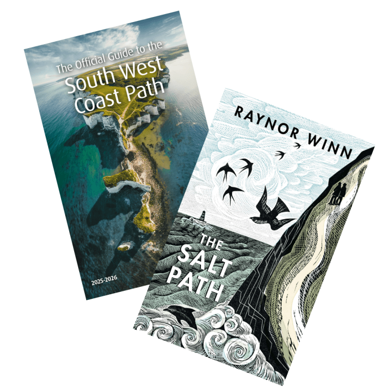
A Taste of The Salt Path
Plan your trip with the Official Guide to the South West Coast Path. The Official Guide is written and produced by the South West Coast Path Association, the charity that protects and champions Britain’s longest National Trail. Containing 52 days of walks across the entire 630-mile National Trail, tides times, accommodation providers and places to eat and drink, our handy guide is sure to help you on your journey—whether you’re planning a weekend trip or even taking on the entire trail.
Check out places to Stay, Eat & Do on the South West Coast Path, and head to our website to learn more about The Salt Path and to download our press pack.
